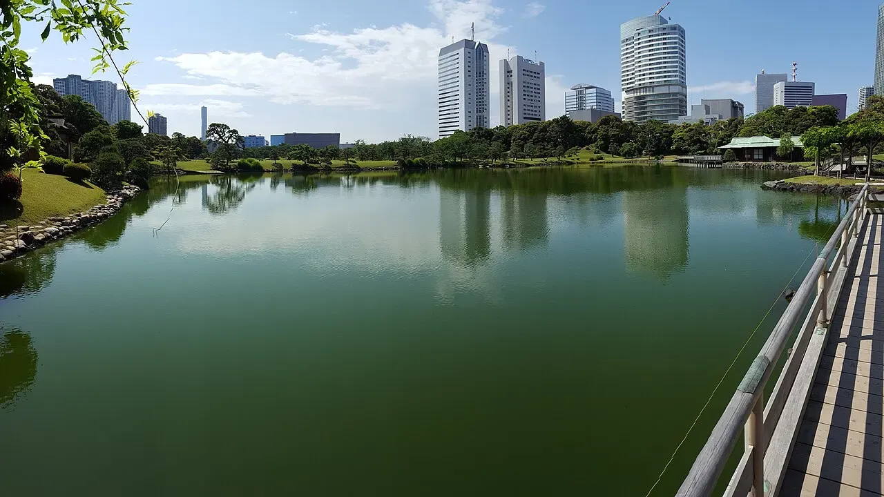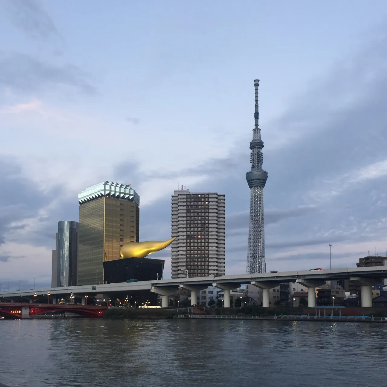
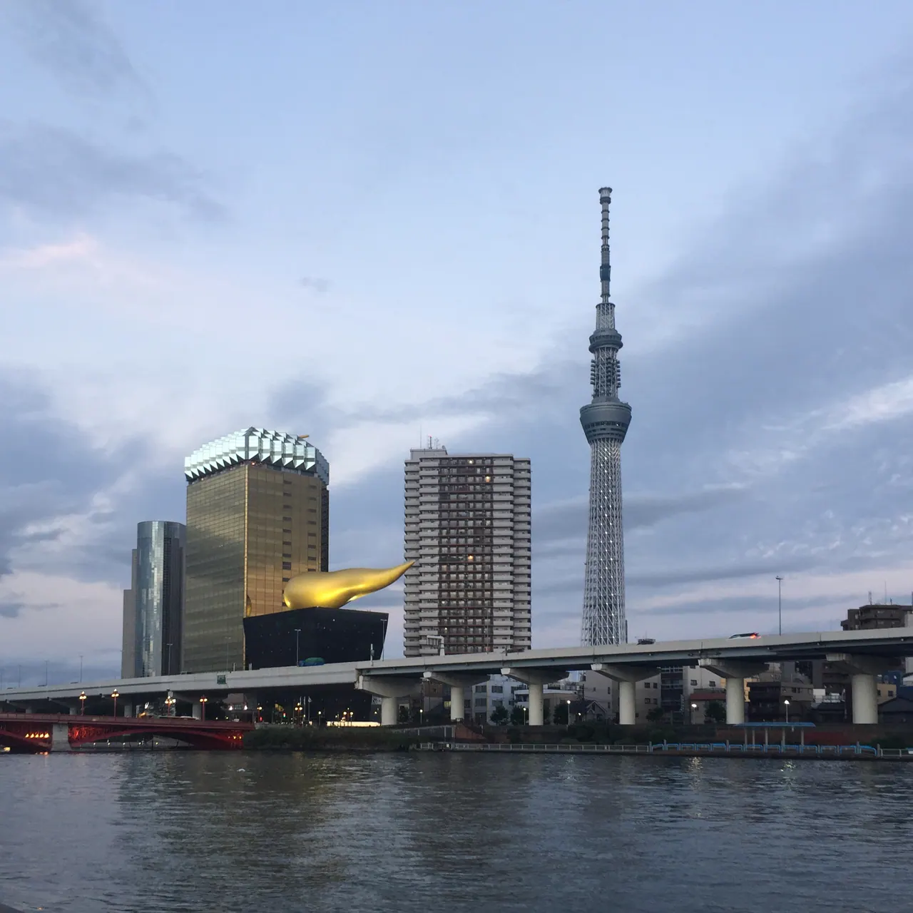
The Sumida River is where the idea for Tokyo Corners began. I live in Asakusa and sometimes run along the river. On one run, I noticed visitors photographing the water and Tokyo Skytree. There weren’t many people nearby, and I wondered whether they could find someone to take a picture of the whole group. I offered to take one. They looked very happy, and I came away wanting to help visitors enjoy more of Japan, including the places woven into ordinary days here.
That encounter is one reason I think a river walk deserves time in an Asakusa itinerary. It doesn’t have to be a long expedition or a race to the tower. On the west bank you can look across the water; on the pedestrian bridge you can watch the river and trains from a different angle. The view changes even though the distance between the two is short.
The route below is a suggested walk, not a reconstruction of my run. Allow roughly 1½ to 2½ hours if you want time to wander, sit and take photos. You can also do a much shorter version. The park and bridge are free; a café stop is optional.
Sumida River Walk is the pedestrian bridge beside the railway; Sumida Park is the riverside park. GO TOKYO lists the bridge’s regular hours as 7 a.m.–10 p.m., though weather or events can affect access. It estimates three minutes on foot from Tobu Asakusa Station’s north exit, or seven minutes from Tokyo Metro Ginza Line Asakusa Station’s exit 5. These are estimates to the bridge area, not times through the stations or along the park.
- Asakusa Station
- Taito City Sumida Park · west bank
- Sumida River Walk · pedestrian bridge
- Return to Asakusa or continue east
The choice before you start
Choose this walk if you want Skytree in your photos without going up the tower, an outdoor break between other plans, or a short walk that is easy to cut back. Choose something else if you need a long, uninterrupted riverside walk: the crossing itself is only about 160 metres, and the time suggested here depends on stopping rather than covering distance.
There are two different places called Sumida Park, one on each bank. This route starts in Taito City’s park on the Asakusa side, then crosses Sumida River Walk toward the Skytree side. You can return the way you came while the bridge is open.
| Part of the outing | Suggested time | What you are choosing |
|---|---|---|
| Asakusa Station to the park | About 5 minutes to the park | Reach the river first, then decide how far to walk. |
| Park and photographs | 30–60 minutes | Walk north beside the water, turn back toward the railway bridge, and stop when you want. |
| Bridge and return | 15–30 minutes, plus your return | Cross for the railway and river views, or skip it if it is closed or someone dislikes noise. |
| Break | 20–40 minutes if wanted | Sit or have a drink before returning or continuing east. |
The access time is the ward’s estimate to the park, not a measured journey through the station. The other times are flexible planning allowances, not timed walking tests. For a quick outing, go straight to the river, look across from the Asakusa bank and return to the station; you don’t need to fill a half day.
Find the river, then decide how far north to go
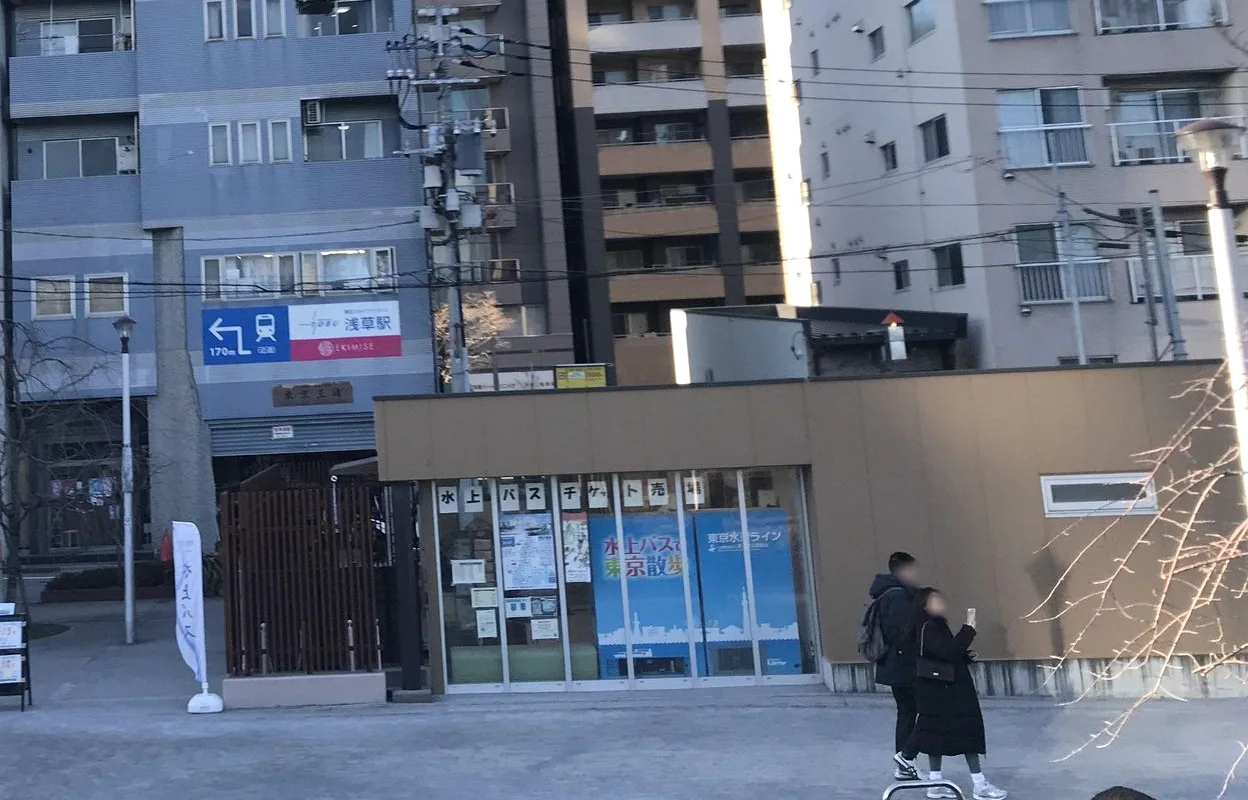
If you arrive on the Tobu Skytree Line, use Asakusa Station’s north exit and head toward the river. From the Tokyo Metro Ginza Line, exit 5 is another starting point. GO TOKYO lists these exits for the bridge area. Look for the railway bridge spanning the water; the pedestrian crossing runs beside it.
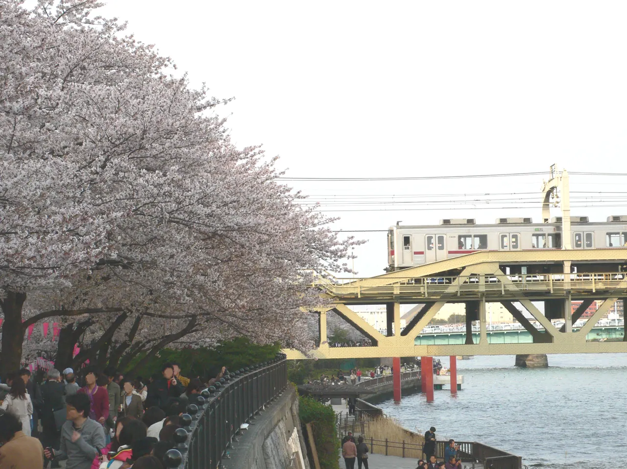
Once in Taito City Sumida Park, walk north with the river on your right. The park follows the bank, so you can turn around whenever the view, weather or your group tells you to. Returning toward the railway bridge brings you back to the crossing. If you are traveling with a child, this is a useful route to leave open-ended: you can have a break at the river without committing to a long loop. For a different half-day plan, our Asakusa guide for young children covers the temple approach and an optional amusement park.
Skytree across the water is the obvious subject, but try two pictures rather than looking for one perfect spot. On the west bank, include some river in front of the tower. At the crossing, try a second frame that includes the railway and the changing traffic on the water. Neither view needs an observation-deck ticket. For a group photo, leave space for the people as well as the tower; it is easy to concentrate on fitting the entire landmark into the frame and make everyone else tiny.
The park is free. Near the railway bridge, the ward’s park information center has rest benches, a nursing room and toilets, including an accessible toilet. Its listed hours are 9:30 a.m.–6:00 p.m.; it closes December 29–January 3 and on the Sumida River fireworks festival day. Those are the center’s hours, not a promise that a particular outdoor seat or toilet will be available whenever you arrive. Check the ward’s page for changes. For other places to take a break, see our guide to where to sit in Tokyo.
Why this riverside has been a place to gather for centuries
The view is unmistakably modern: Tokyo Skytree rises across the water and trains pass immediately beside the pedestrian bridge. The idea of coming to the Sumida for a day out, however, is much older. A Taito City history of the cherry trees traces blossom viewing along the river to the Edo period. In 1717, the eighth shogun, Tokugawa Yoshimune, added 100 cherry trees along the Sumida embankment as part of creating places for townspeople to enjoy the flowers.
That does not mean the trees you see on this walk have stood here since 1717. Floods, earthquakes and war damaged the blossoms over time. The ward says that many of the trees in the present park were planted around 1980. In its count dated April 1, 2025, the Taito City side had approximately 400 cherry trees of about 20 varieties. The count is a dated record, not a promise of the number or condition you will find today. The ward’s tree-care page describes work to maintain them, including pruning and improving the soil around their roots.
The park’s shape has a more recent history too. After the 1923 Great Kanto Earthquake, Tokyo’s reconstruction plan included Sumida Park among three large parks. According to Taito City, the plan used both banks: the Honjo side revived a cherry-lined embankment, while the Asakusa side was planted with willows for walking and rest. The old row of willows no longer remains on the Asakusa side. Today you can still read the larger idea in the two long strips of public space beside the river, even though the planting and the skyline have changed.
That history gives the walk a second layer. The flowers are worth seeing for themselves, but the park is also a place that people have repeatedly rebuilt and cared for. You do not have to visit in peak bloom to appreciate the river’s role as a place to meet, walk and pause.
What visitors noticed about the park
We reviewed Google Maps comments for Taito City Sumida Park and found a more useful contrast than simply “quiet” or “crowded.” Some people enjoyed stopping for photos or walking while looking across at the tower. Others described a very different visit: one person who went during the blossoms on March 29, 2026 said the crowd made it difficult to take the pictures they wanted. Another wrote about enjoying full bloom in the rain on April 4, 2026. Those are two individual visits, not a forecast for a future cherry-blossom season.
A few practical frustrations appeared alongside the praise. One reviewer wanted more shade in strong sun; another found it difficult to find a bin. A different reviewer enjoyed stopping on a quieter rainy day. None establishes today’s facilities or how busy your visit will be. Together they suggest bringing water, carrying a small bag for your own rubbish, and giving yourself permission to move on if a particular stretch feels uncomfortable. For cherry blossoms, check the ward’s flowering information before setting out, and check the date of its latest update, rather than assuming the trees will be at their peak.
This is an editorial reading of the comments, not a survey of everyone who visits. We had records of 238 park reviews and 173 bridge reviews read on November 5–6, 2026. The park sample includes new and low-rated posts; bridge comments were collected using several sorts and a search term. Some were displayed through automatic translation, and individual review links were not available for all of them. The mix cannot tell you the proportion of visitors who enjoyed a view or found a crowd.
Cross beside the trains
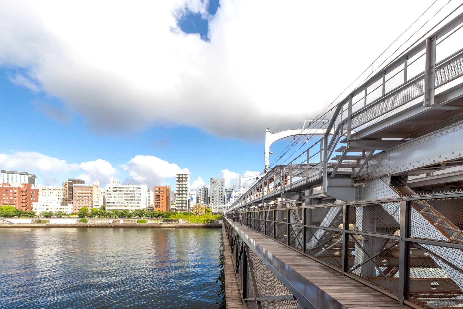
Turn back toward the railway bridge and take Sumida River Walk east. The crossing runs beside the tracks, with glass sections where you can look down toward the water. GO TOKYO gives its length as approximately 160 metres and its regular hours as 7:00 a.m.–10:00 p.m. It is free to cross; bicycles must be pushed.
This is a bridge where the train is part of the attraction, and that is also its trade-off. In the bridge reviews we read, one person liked feeling the vibration as a train passed. Another found the noise loud enough to question whether the detour was worthwhile. A third thought the sound might surprise a child. If anyone in your group is sensitive to sudden noise, tell them what to expect and let them decide whether to cross. The west-bank view remains an option.
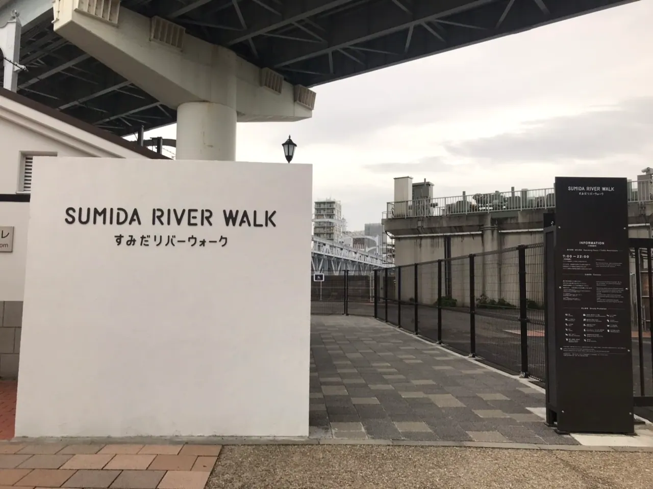
Some people mention the wind, especially in winter. A photographer in the comments described crossing in about five minutes while taking pictures; that is one visitor’s experience, not a guarantee. The operator’s own route leaflet budgets 10 minutes in one itinerary and 30 in another. You can use the difference as a planning cue: this is a brief crossing if you keep moving, and a longer stop only if you choose to make it one.
Weather or events can change access. GO TOKYO lists the regular hours, but we could not confirm current temporary closure notices when we checked on November 6, 2026. If a late-evening crossing matters to your plan, check the latest information before leaving and keep a way back in mind. If the bridge is closed, stay on the Asakusa bank rather than assuming you can cross here.
When to come: daylight, blossoms or evening
Daylight makes it easier to see where you are going and to notice the different views from the bank and the bridge. It is also the simpler choice if your break depends on the park information center: its listed hours end at 6 p.m. Check the weather before leaving, because the crossing is exposed; a clear view and a comfortable walk are different things on a windy or very hot day.
Cherry-blossom season adds something distinctive, but do not build the whole day around a prediction made months ahead. The ward’s flowering page has a date on each update. Look at the date as well as the photographs: an update from a previous spring is useful context, not a report on today’s trees. In the comments we reviewed, one visitor was disappointed when the trees were not yet in bloom, while others described a full canopy. Those accounts explain why two people can return with very different impressions of the same walk without either being wrong.
Evening changes the scene again. GO TOKYO describes the bridge and tower lighting up after sunset, while visitors in our review sample described the night view, the railway and the winter wind. The official normal closing time is 10 p.m. One review described crossing at a time that does not agree with that schedule; use the operator’s current information, not a review, when planning your return. A night view is a reason to bring a warmer layer and leave a margin before closing, not a reason to assume the route is open all night.
For November 7, 2026 to January 31, 2027, Tobu lists a bamboo-light display around the Sumida River Walk and nearby areas, scheduled for 5–10 p.m. The separate lighting on the Kitajukken River has different dates and hours; check the event page before going.
A sample 90-minute version
If you want a plan you can adjust on the spot, start with the park rather than the far side of the river. Give the station-to-park approach a little time, then spend about 30 minutes walking north and back toward the railway bridge. Use another 15–20 minutes to cross and enjoy the view if the bridge is open. Return across it, then use the remaining time for a drink, a photograph or a rest before heading toward the station. These are planning choices, not measured times; a queue, a child’s pace or the weather may change them.
The key decision comes before crossing: do you want the train-and-river view enough to add the return crossing? If the answer is no, stay on the Asakusa bank and spend the same time looking across the water. That is still the walk, not a failed version of it. If the answer is yes, check the bridge’s closing time before you go, especially if you intend to return by the same route.
For a group photograph, make the pause a deliberate part of the plan. Choose a spot without blocking the path, let people settle into the frame first, and then decide how much of the river and tower you want behind them. The tower is tall enough that trying to include every part of it can make faces small. One useful alternative is to take one wide picture for the setting and a closer one of the people; you do not need to solve both problems in a single shot.
Make the walk fit your day
With limited time: spend 30–45 minutes at the park and turn back. You still get the river and tower without making a second crossing.
With time for a break: walk north along the park, return to the railway bridge and cross. At the east end, look back across the river, then either return over the bridge while it is open or continue in the direction of Skytree. Allow extra for a drink or snack if you decide to stop; individual shops set their own hours and prices.
In blossom season: bring a flexible plan rather than a promise of a quiet photo. The same place can feel spacious or frustrating depending on the particular visit. A rainy day, a weekend and a festival day are not interchangeable, and neither are individual travelers’ expectations.
With a stroller or limited mobility: the information center offers an accessible toilet, but we have not measured the complete route’s slopes, surfaces or step-free station exits. Check the latest route and facilities for your needs rather than treating this article as an accessibility assessment.
The best length for this walk is the one that leaves you wanting to be there. A short stop at the river can be the whole outing; crossing the bridge is a choice, not a requirement.